3D City Renderer
Project information
- Technology Used: Python, VTK, PyQT, MapBasic, MapInfo Pro
- Project Duration: Jun - Aug 2022
- Project URL: Link
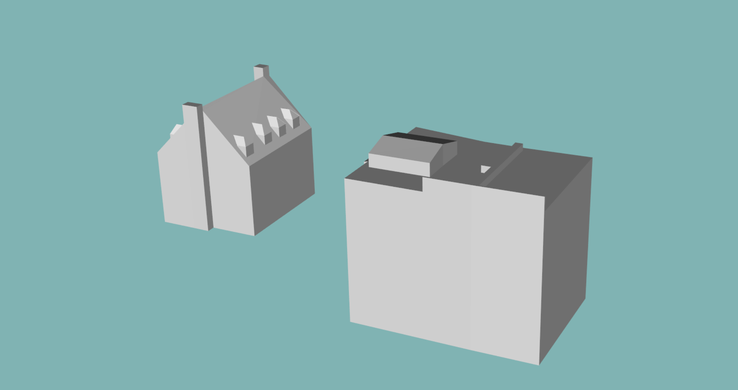
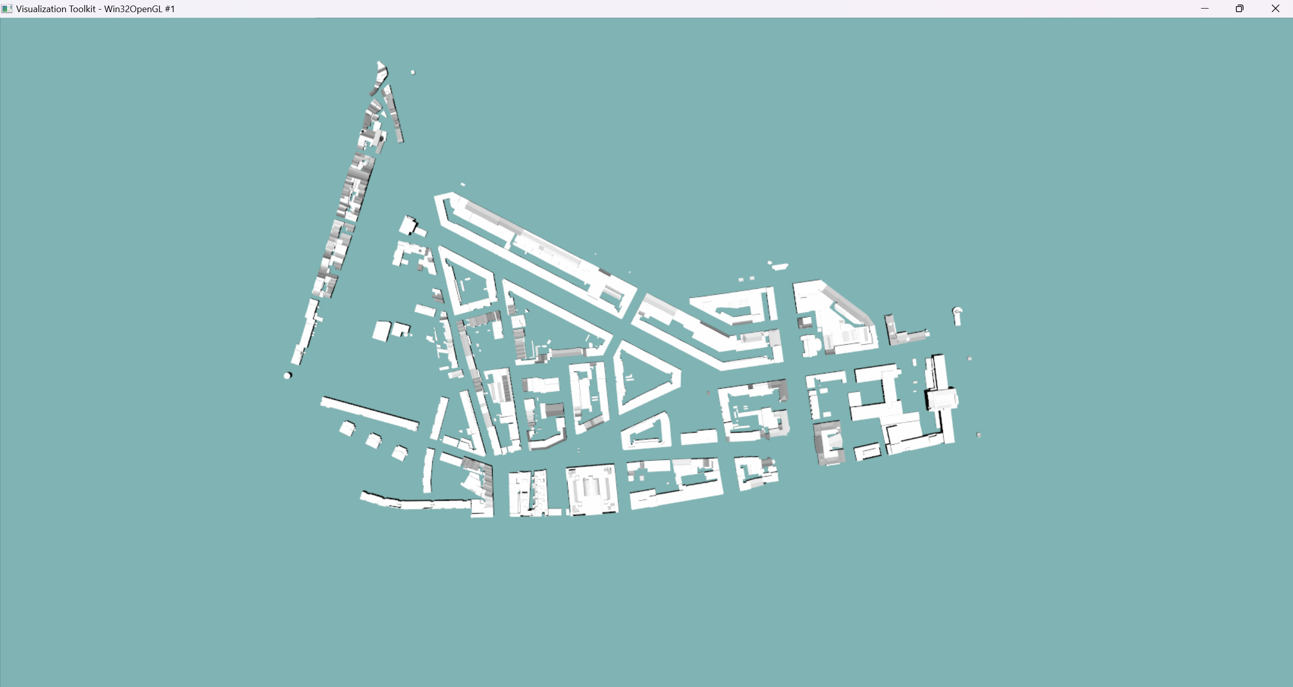
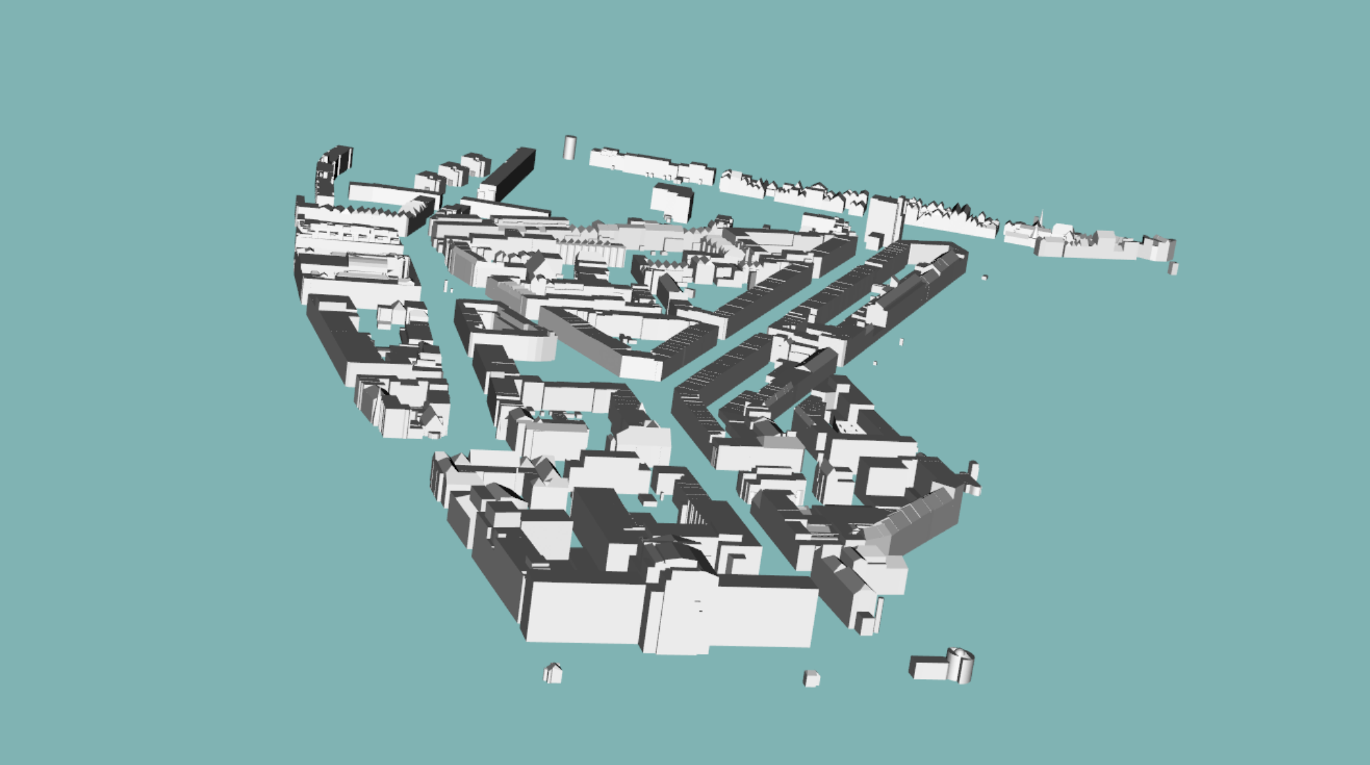
This project was done as a part of my internship at Precisely. The project involved reading GML data from JSON and XML files for city model and render it using Python and VTK. The renderer was integrated with MapInfo Pro, a GIS software, to render the 3D city model on the map. The renderer was also capable of rendering the city in top-down view and in 3D view and specify the LOD and even read texture data. The renderer was capable of rendering large cities with thousands of buildings and roads.